SAT NAV · GUIDE
Motorhome sat navs, sorted.
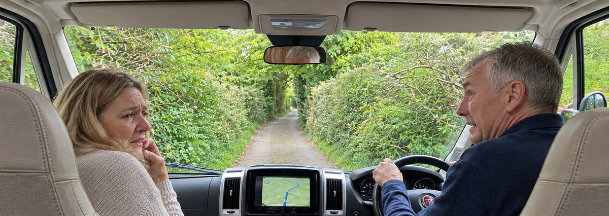
Every seasoned motorhomer has a story about the day they ended up on a single track country lane with a tractor coming the other way. A proper motorhome sat nav makes that less likely, but not impossible. They're not the perfect solution we would all like them to be... but why? Here's how they really work, which ones are worth your money, and the habits that keep you out of the hedges.

By Ged Wilmot · Facts checked
Some of the links on this page earn us a commission if you buy through them, at no extra cost to you. It doesn't change what we recommend: we pick what we'd buy ourselves, and we say when the cheaper option is the better one.
In a nutshell...
It knows the signed limits and low bridges in its map. It doesn't know the hedges on an unmarked lane in Devon are two inches from your mirrors.
The sat nav knows your van's size and steers round the low bridges and width limits in its map. Google Maps is better at live traffic and warning you what's ahead. We run both on every trip.
A £780 sat nav fed the brochure height is worse than a £230 one fed a measured height. Twenty minutes with a tape measure beats any upgrade.
The Garmin Camper 795 (£329.99) or the TomTom GO Camper Max (£349). On a tighter budget, the TomTom GO Camper Tour (£229.99).
See the best sat navsYour real height, width, length and weight, measured properly and printed on a free card for the cab, in metres and feet.
Make my cardWhy does my sat nav send my motorhome down narrow lanes?
Because the map knows less about little roads than you'd hope.
Think of the map inside your sat nav as an enormous spreadsheet, with one row for every stretch of road in the country. The columns hold whatever somebody has recorded: the type of road, the speed limit, a 7.5-tonne weight limit, a 6ft 6in width limit, a low bridge. When you enter your van's size, the sat nav filters out the rows with a limit you'd break. That part works well.
The trouble is the empty boxes. There is a column for how wide a road physically is, but on most country lanes it's blank, because nobody has driven every lane in Britain with a tape measure. A lane can be barely wider than your van, with no passing places and a stone wall either side, and still carry no restriction, because nobody ever put up a sign. With nothing to check your width against, the lane stays in the running. If it happens to be the quickest way to the campsite, that's where you're going.

Road width data does exist, to be fair. Ordnance Survey's detailed road data for Great Britain includes low bridges and height, weight and width limits, and its documentation describes road widths within urban areas. Out in the lanes, where the trouble is, the picture is much thinner. No sat nav maker publishes how much width data it uses or how heavily its routing weighs it, and in OpenStreetMap, the free map behind several apps, actual widths are recorded on very few roads at all.
Two more things catch sat navs out. Maps lag behind real life, so a new restriction or a changed junction can take a while to appear. And no map anywhere records how far the branches hang over a lane in July.
A sat nav is good at obeying rules and bad at judging character. It can avoid a sign it knows about. It can't look at a lane and think, "I wouldn't take a seven-metre van down there."
The clearest admission we found came from the company behind the CoPilot app. When a UK owner complained it kept choosing single-track lanes, it replied publicly: "Even with the correct caravan profile set, our routing can occasionally pick unsuitable lanes." Garmin says much the same in more careful language. Credit to both for saying it out loud. It tells you this is a limit of the technology, not a fault with your particular box.
Will a sat nav warn me about low bridges?
Usually, if the bridge is in its map and you've entered your height. Network Rail shares data on more than 5,000 bridges, including every low bridge involved in a reported strike since 2000. It's careful to say that where its data and the signs at the bridge disagree, the signs win. The Department for Transport adds that warning signs aren't put up in advance of every low bridge, so keep your eyes open.
It matters, because it keeps happening. Network Rail says a vehicle hit one of its bridges every five hours between April 2024 and March 2025.
Watch arched bridges in particular. The height on the sign often only applies in the middle, between the markings, and the clearance drops away quickly towards the sides. A high motorhome that drifts off-centre can clip an arch its sat nav said was fine.
Do I need a special sat nav for a motorhome?
If your van is over about 2.5 metres high, wider than a car or heavier than 3.5 tonnes, yes, or at least a proper motorhome app.
Hiring a motorhome? Ask whether the hire company offers a motorhome sat nav, and see our motorhome hire guide for what to check before you book.
The ordinary Google Maps app doesn't let you enter your vehicle's size. Neither does Waze, whose only vehicle choices are private car, taxi and motorbike. They'll happily route a 3.2-metre-high coachbuilt under a 3-metre bridge, because as far as they're concerned, you're a Fiesta. Google does have a large-vehicle routing system, but it's a paid service for businesses, not part of the Maps app on your phone, and Google warns it can't guarantee those routes either.
A motorhome sat nav or app does three things an ordinary one won't:
- It takes your dimensions and avoids the signed restrictions and low bridges it knows about.
- It knows about campsites. Most come loaded with directories from ACSI, ADAC, Campercontact and others, so you can find sites, aires and service points on the way.

- It usually has a caravan mode too, for a car and caravan outfit, which is a different shape and weight again.
The Caravan and Motorhome Club's advice on its own route planner sums it up: "Please treat every route with caution as some may not be suitable for caravans." Good advice, whatever you're using.
Should I use Google Maps as well as a motorhome sat nav?
We do, on every single trip, because they're good at different things. The motorhome sat nav is there for your size: height, width and weight. Google Maps is there for everything that changes by the minute.

One rule when you run both: if Google Maps wants to take you a different way from the motorhome sat nav, remember that only one of them knows how big your van is. Check what's on Google's route before you follow it.
How do I measure my motorhome's height?
Properly, once, and then keep the numbers where you can see them. Every sat nav is only as good as the figures you type in, and most people type in the wrong ones.
The brochure height is the manufacturer's number, not yours. It was measured before the dealer fitted a satellite dome and before you added solar panels. The same goes for weight: the brochure gives you the van empty, not loaded for a fortnight with two people, a full water tank and too many shoes.
Measuring height without climbing on the roof
- Park on level ground.
- Stand a long batten or a broom upright against the side of the van, so it reaches past the roof.
- Get someone to hold a spirit level or straight edge flat across the highest point on the roof until it touches the batten, and mark the spot.
- Measure from the ground to the mark.
Measure to whatever is highest: the aerial when it's down, a satellite dome, solar panels and their brackets, an air conditioning unit, a roof box or roof bars. If something is only sometimes up there, measure with it on. One day you'll forget it's there.
Add a little wiggle room. Round your height and width up to the next 5 centimetres, then add another 5. If your tape says 3 m 14 cm, call it 3.20 metres. Our free dimensions card does the sum for you. Rounding down to make the numbers look tidy is how people hit bridges. A few centimetres extra costs you nothing, apart from the odd bridge you'd have squeezed under anyway.
Width, length and weight: what to measure
Width: measure across the mirrors. Width limits are normally measured without mirrors, but the mirrors are what meet the hedges and the oncoming lorries, and they can add 20 to 30 centimetres. So enter your width with mirrors in your sat nav, and keep that figure on your card.
Length: measure to the very back. Include the bike rack, towbar or scooter carrier if they stay on. For a car and caravan, measure the whole outfit hitched up. Ferries and tunnels ask for it, and hardly anyone knows it.
Weight: use your maximum. Enter the maximum authorised mass (MAM) from your V5C or the plate on the van, in your sat nav and on your card. Then make sure you're under it: a trip over a public weighbridge, loaded for a holiday, tells you what you actually weigh.
Keep the numbers in feet and inches as well as metres. UK low bridge signs are still shown in feet and inches, and plenty have no metric figure at all. Your sat nav and every sign in Europe want metres. Nobody wants to be converting in their head with a bridge getting closer, so keep both on a card in the cab, and measure again whenever you fit something to the roof or the back.
What to look for in a motorhome sat nav
The devices look alike in the shop. These are the things that actually make a difference on the road:
- A proper vehicle profile. You should be able to enter height, width, length and weight, and ideally save more than one profile (the motorhome, and the car you tow behind it, say).

- Screen size. Seven inches is the sweet spot in most cabs: big enough to read at a glance, small enough not to block the view. Five inches feels cramped. Ten inches is lovely, until you try to find somewhere to mount it.
- Free map updates over WiFi. Roads, restrictions and campsites change. All the current Garmin and TomTom camper models update over WiFi without a computer.
- European coverage. Check the maps cover every country you plan to visit. Most camper models include Europe as standard.
- Camper points of interest. Look for the campsite directories you already use, such as ACSI or Campercontact.
- Traffic. Most models get live traffic through an app on your phone, and some traffic and speed camera features need a paid subscription, so check what's included. Plenty of owners, us included, just run Google Maps alongside for traffic.
- A way to check the route before you commit. A clear route overview, and on Garmin models, BirdsEye satellite imagery, let you look at the approach before you're on it.
The best motorhome sat navs in the UK (2026)
We haven't driven all of these down the same lanes side by side, and neither, as far as we can find, has anyone else. There's no independent test that compares current models on the same unsigned roads, so any review that crowns a winner on routing is giving you an opinion. This is what the makers' own documents and prices show, checked 16 November 2026, plus what owners told us in the motorhome groups.
| Sat nav | Screen | Price | Best for | Worth knowing | Where to buy |
|---|---|---|---|---|---|
| Garmin Camper 795 | 7in | £329.99 at Garmin | Our pick | BirdsEye satellite view for checking arrivals |  |
| TomTom GO Camper Max (2nd gen) | 7in | £349 at TomTom (Premium pack £399) | Best with world maps | Monthly map updates over WiFi | |
| TomTom GO Camper Tour (2nd gen) | 6in | £229.99 at TomTom | Best on a budget | Europe maps only, smaller screen | |
| Garmin CamperCam 795 | 7in | £499.99 at Garmin | Sat nav and dash cam in one | Costs about the same as buying both separately | |
| Garmin Camper 895 | 8in | £579.99 at Garmin | Bigger screen | A big jump in price over the 795 | |
| Garmin Camper 1095 | 10in | £779.99 at Garmin | Biggest screen | Doesn't route any better than the 795 | |
| Snooper Ventura range | 5in to 9in | £269.99 to £399.99 | Snooper fans | Less published detail than Garmin or TomTom | Check price at Snooper |
Prices are the manufacturers' own UK prices, checked 16 November 2026. Retailers are often cheaper.
Garmin Camper 795: our pick

The price is £329.99 at Garmin. It has a 7-inch screen, maps from HERE (one of the big map makers), routing by size and weight, WiFi updates, live traffic through the Garmin Drive app, and campsite directories including ACSI and Campercontact.
If you made us choose one, this is it, for three reasons. It's current and properly supported. Garmin says plainly in its own documents that the vehicle profile isn't a guarantee, which we'd rather hear than a promise nobody can keep. And its BirdsEye satellite imagery lets you look at the real approach to a site before you get there, which helps with the last half mile, where most of the trouble happens.

It's also the one owners recommend most in the motorhome groups, by a distance. The two gripes we saw more than once: the speaker isn't very loud, even turned right up, and people who'd owned Garmin's first Camper model found it disappointing next to the newer ones. So if you're buying second-hand, check which generation it is.
TomTom GO Camper Max: best with world maps

TomTom's 7-inch model is £349 at TomTom, or £399 with the Premium pack. It has world maps, saved vehicle profiles, monthly map updates over WiFi and live traffic through your phone. If you prefer TomTom's screens and menus, buy this instead of the Garmin and you won't be worse off. It's the one on our dashboard, and we bought it second-hand for a fraction of the price.
Owners in the groups are more mixed about TomTom than Garmin. One camper van owner's first trip ended in a beach car park their van was too long for, followed by a dirt track diversion barely wider than the van. Blame the width problem every sat nav has rather than TomTom in particular, but it's a good reminder that the box doesn't do the looking for you.

TomTom GO Camper Tour: best on a budget

The cheapest current camper model from a big name is £229.99 at TomTom. You get a 6-inch screen, camper and caravan routing that avoids roads, bridges and tunnels your dimensions won't suit, monthly WiFi updates, live traffic through your phone, and campsite listings from ACSI, ADAC, ANWB and others. The maps cover 46 European countries, which is plenty for most owners. The small screen is the compromise, and it matters more than you'd think when it's stuck to a big motorhome windscreen.

More sat navs: dash cam combo, bigger screens, Snooper and Aguri
Garmin CamperCam 795: sat nav and dash cam in one


The Camper 795 with a dash cam built in is £499.99 at Garmin. Fewer wires and one gadget on the windscreen instead of two. A decent separate dash cam and a 795 cost about the same, though, and if one breaks you don't lose both.
Garmin Camper 895 and 1095: bigger screens


The same Garmin camper features on an 8-inch screen (£579.99 at Garmin) or a 10-inch one (£779.99 at Garmin). The bigger screens are easier to read if your eyesight isn't what it was, but they don't route any more safely, and a 10-inch unit needs a big, flat bit of dashboard. Sit in your cab with a tape measure before you buy.
Snooper Ventura: a UK alternative
Snooper is a long-established British name, with a range of motorhome and caravan sat navs: the 5-inch S5100 Ventura-Pro (£269.99), the 7-inch S6900 Ventura-Pro (£379.99), the 5-inch SC5900 Ventura-Plus with a built-in dash cam (£369.99) and the 9-inch S9900-Pro (£399.99). All four were on offer when we checked, at £199.99 to £299.99. They take your vehicle's dimensions and have a loyal following: one owner in the groups said they'd tried most of the big names and gone back to their Snooper. Snooper publishes less detail than Garmin or TomTom about whose maps it uses, what updates cost after the first year and how long each model will be supported, so ring them and ask before you buy.
Aguri: worth a call
Aguri is another British brand, selling the RV520, RV760 and RV7000M motorhome and caravan sat navs with what it calls free lifetime map and speed camera updates. We couldn't confirm current prices, map suppliers or update terms from its website, so we can't recommend them either way yet. If one catches your eye, ask Aguri those questions before you buy.
Can I use a lorry sat nav in a motorhome?
You can, but we wouldn't. Truck sat navs like the TomTom GO Expert Plus and Garmin dēzl range happily take big dimensions, but they route you like a 44-tonne artic, not a 3.5-tonne motorhome. They stick to the lorry network, apply loading and hazardous-goods rules that don't apply to you, and fill the map with truck stops and weighbridges instead of campsites. If your motorhome is over 7.5 tonnes or you tow something enormous, it's worth a look. For a normal coachbuilt or panel van conversion, buy the camper version.
What about the cheap truck sat navs on Amazon?
The £50 to £80 "HGV, van and motorhome" sat navs from brands you've never heard of come up a lot in the groups, and the people who've bought them are mostly happy. They'll take your height and weight and steer you round the limits they know about. But even their fans say what we've said all along: they'll still send you down a road you think is unsuitable, because the width data isn't there. The other catch is that these sellers rarely say whose maps are inside or how long updates will keep coming. For a van you've spent tens of thousands on, we'd spend a bit more on a Garmin or TomTom, or buy one of those second-hand.
Should I buy a second-hand motorhome sat nav?
Yes, if you check a few things first. Motorhome sat navs don't wear out much, and plenty get sold on when someone changes van or gives up touring. Ours is a TomTom GO Camper Max (2nd gen) from another owner in a motorhome Facebook group. We paid £120, against £349 new, and it still had the screen protector on. Bargain.
The catch is that sat navs are tied to their owner's account, and that can quietly switch off the useful bits. One owner in the groups bought a second-hand TomTom, set it up, and couldn't work out why it showed speed cameras but no traffic or road closures. The advice that came back was that the previous owner's account was probably still attached.
Before you hand over the money
- Check it's the current generation. For TomTom that means "2nd gen" camper models. For Garmin, the Camper 795, 895 or 1095. An older model may no longer get map updates.
- Ask the seller to remove it from their account. TomTom's own instructions: they delete it from the Products tab in their TomTom account, then on the sat nav go to Settings, TomTom account and tap "stop syncing". Garmin works the same way through the seller's Garmin account.
- Reset it and register it to you. Do a factory reset, then sign it into your own account and run the map updates over WiFi before your first trip.
- Check the traffic actually works. On TomTom models, owners point to Settings, System, About, where traffic should show as activated. Then zoom out on the map: if you can see roads marked in yellow or red, the live traffic is coming through. If it says activated but shows nothing, contact TomTom. Owners report they'll reactivate it.
- Expect to use your phone for the connection. Owners say the built-in SIM on older TomToms often stops working, so you pair the sat nav with your phone over Bluetooth instead.
- Make sure the mount and charger are in the box. A replacement mount costs more than you'd think, and a sat nav with no mount is a very expensive paperweight.
Sat nav apps for motorhomes
If you'd rather use your phone or a tablet, a proper motorhome app does most of what a dedicated sat nav does, for less money. The downsides are a smaller screen (unless you use a tablet), your phone getting hot on the dashboard in summer, calls and messages popping up over the map, and usually a subscription.
Sygic GPS Truck & Caravan
The strongest app we found for entering your vehicle's details: size, weight, trailers and more, with offline maps you download in advance. Despite the name, it has camper and caravan modes. Pricing is a maze of monthly, yearly and lifetime options; at the time of checking, camper maps for Europe were £49.99. One reviewer noticed it seemed to round their dimensions to the nearest standard figure, so check the numbers it's actually using. Rated 4.4 out of 5 on the App Store.
See it on the App StoreCoPilot
Has a proper caravan and motorhome mode (it calls it RV) and offline maps, at about £26 to £30 a year for caravan navigation at the time of checking. Here's the odd thing: its store ratings are the weakest of the three, yet it's the app motorhome owners recommend most in the groups, some after years of use without a problem. They like that it works with no signal and goes with you from the van to the car. Its makers are also the ones who admitted it can occasionally pick unsuitable lanes, which is honest. The maps take up a fair chunk of phone storage. Rated 3.1 out of 5 on the App Store.
See it on the App StoreOsmAnd
Free to start, with paid upgrades. It uses OpenStreetMap, works fully offline and lets you set height, width, length and weight limits. It's the most transparent of the lot, but it takes some setting up, and it's only as good as the volunteer map in your area. For keen tinkerers.
See it on the App StoreYou'll also see Eurowag Navigation recommended in the groups as a free option. It's a lorry app, so it takes your dimensions, but it routes you like a lorry (see lorry sat navs above). It's also no longer quite free: the full version is £79.99 on the App Store, and recent reviews complain that features which used to be free have moved behind it.
What sat navs do motorhome owners actually use?
Reviews tell you what a sat nav can do. Owners tell you what it's like to live with. So in September 2026 we read around 50 replies to "which sat nav should I buy?" posts across six UK motorhome, campervan and caravan Facebook groups. It's not a scientific survey. People who love their sat nav are keener to say so than people who can't be bothered. But it's a fair picture of what's on real dashboards.
| What they use | How often it came up | What owners said |
|---|---|---|
| Garmin Camper (770, 795, 1095) | Most mentioned, about 12 times | Takes the stress out of it. Good across Europe. Shows campsites on the way. Speaker a bit quiet |
| CoPilot app | About 7 | Loyal fans, some after years. Works with no signal. Goes from van to car |
| TomTom (camper, truck or app) | About 6 | Mixed. Some happy, one took theirs out and went back to Google Maps |
| Cheap truck sat navs from Amazon or eBay | About 5 | Happy with them for the money, but they still find narrow roads |
| Eurowag Navigation (lorry app) | About 4 | Liked because it was free. It's moving to paid |
| Just Google Maps or Waze | About 4 | Mostly smaller vans that fit down most roads anyway |
| Snooper, Aguri, Magic Earth | Once or twice each | Each had one fan |
What struck us more than the brands was how much owners agree on everything else.
Nobody trusts the sat nav completely. "Sat navs are a guide" came up again and again, from people with dear ones and cheap ones alike. One owner put the width problem better than we did: "very few roads have width info."
The experienced ones check the route before they go. Owners who rarely get caught out described looking at the tricky bits on Google Maps or Street View the night before, sticking to A roads where they can, and keeping a road atlas in the van for when the plan falls apart.
Some pad their dimensions. A few owners enter their van as a little bigger than it really is, to build in a margin. See the quick questions for our take.
The phone-versus-box argument is alive and well. Some owners can't see why they should buy another gadget when their phone already streams music to the stereo and runs Waze. Others want a dedicated screen that doesn't ring. There's no wrong answer, as long as whatever you use knows how big your van is.
"If there are no white lines down the middle I avoid it."One owner's answer to "Which sat nav would you recommend?"
How to stop your sat nav getting you stuck
The owners who never end up reversing half a mile down a lane aren't the ones with the dearest sat nav. They're the ones with the best habits.
- Enter your real dimensions, and pick the right profile. Motorhome, car and caravan, and truck all route differently. If you've added a roof box since last time, update the height.
- Avoid "shortest route". It's the setting most likely to cut down a lane to save half a mile. Avoiding tolls, ferries, motorways or low emission zones can do the same, so know what you've ticked.
- Plan it at home, not in a lay-by. The night before, look at the whole route on a big screen. Not the list of turns, the shape of it. Anywhere it leaves a main road for no obvious reason deserves a closer look, and if you'd rather it went a different way, add a stop along the road you want (sat navs call these waypoints or via points) to hold it on the A roads.
- Check the last few miles separately. That's where the wrong turns, back lanes and tight farm entrances are. Look at the approach on Street View or satellite imagery, bearing in mind the pictures can be years old and hedges grow. In our van, Claire does this on her phone from the passenger seat, and it's saved us more reversing than any sat nav setting.
- Use the campsite's own directions. Many sites publish a recommended route in, precisely because sat navs get it wrong. The Caravan and Motorhome Club points members to its tried-and-tested site directions for the same reason. If the site says "ignore your sat nav after the church", ignore it after the church.
- Watch for the white line disappearing. When a road loses its white centre line, it's often because it's too narrow for one. Plenty of experienced owners treat that as their cue to stop and think, whatever the sat nav says.
- Keep a road atlas in the van. A current one helps you work out a way round when the sat nav's route looks wrong, or when a diversion takes you off its plan. Diversions are exactly when a sat nav is at its least reliable.
- Stop before you commit. If a sign, a narrowing road, a bridge or a hedge disagrees with the sat nav, pull over somewhere safe and think. The signs win, every time. It's much easier to turn round at the top of a lane than halfway down it, and no sat nav has ever been offended by being ignored.
What nobody can tell you yet
Most buying guides don't have a section like this. We think it's one of the most useful bits, because it's what nobody can currently answer, however confident the review sounds.
- How complete each maker's width data is for UK lanes. None of them publishes it.
- How much each sat nav weighs road width against speed and road type when it picks a route. That's their secret recipe.
- Which sat navs, if any, use Network Rail's bridge data, directly or through their map supplier.
- Any independent test of current sat navs and apps on the same set of awkward roads. We looked hard. It doesn't seem to exist.
- Snooper and Aguri's map suppliers, update costs and support periods, which is why neither ranks above Garmin or TomTom here.
If any of that changes, or a manufacturer wants to answer on the record, we'll update this page and say so.
Quick questions
Can I use speed camera alerts in Europe?
Not everywhere. France, for one, bans devices from showing you where speed cameras are, and other countries have their own rules. Many sat navs switch to general "danger zone" warnings in France automatically, but check your settings before you cross the Channel rather than finding out from a gendarme.
Can I use Google Maps in a motorhome?
Yes, and we do, every trip, for live traffic, warnings about what's ahead and its voice search. Just don't use it on its own: the Google Maps app has no way to enter your van's height, width or weight, so it can't avoid a low bridge or a width limit for you. That's the motorhome sat nav's job.
Is a sat nav or a phone app better for a motorhome?
A dedicated sat nav has the bigger screen, stays mounted, and doesn't get interrupted by calls. An app costs less, you already own the phone, and it comes with you when you leave the van at the campsite and take the car. If you tour a lot, the sat nav is easier to live with. If you tour now and then, a good app like CoPilot or Sygic GPS Truck & Caravan does the job. Owners argue about this endlessly, and both camps get where they're going.
Should I enter my motorhome as a bit bigger than it is?
A little, yes. Round your height and width up to the next 5 centimetres and add another 5, as we suggest in measuring your van, and that's your margin built in. Some owners pad their figures much more than that, but go too far and your sat nav will start sending you miles round to avoid limits you'd have cleared easily, which is its own kind of daft. Enter what you measured, rounded up, and let the road signs do the rest.
Why isn't live traffic working on my second-hand sat nav?
Usually because it's still linked to the previous owner's account, or its built-in SIM has stopped working. Get it removed from their account, reset it, register it to yourself and pair it with your phone. There's a full checklist in buying second-hand.
Who checked this page
Sources
Sources, checked 16 November 2026:
- TomTom GO Camper Max and GO Camper Tour, for features and prices.
- Garmin Camper 795, Camper 895, Camper 1095 and CamperCam 795, for features and prices.
- Snooper sat navs and Aguri motorhome sat navs.
- App Store listings for Sygic GPS Truck & Caravan and CoPilot, and OsmAnd's vehicle settings.
- CoPilot on Google Play: the company's public reply to a UK review, August 2026.
- TomTom: removing a device from your TomTom account, for the second-hand checklist.
- App Store listing for Eurowag Navigation, for its current price.
- Owner comments: public posts in six UK motorhome, campervan and caravan Facebook groups, read in September 2026. Not linked, to protect the people who posted.
- Waze vehicle types and Google's Large Vehicle Routing.
- Ordnance Survey: Routing and Asset Management Information, for what OS road data records.
- Network Rail: prevention of bridge strikes and a vehicle hits a rail bridge every five hours.
- Department for Transport: prevention of bridge strikes good practice guide.
- Caravan and Motorhome Club: planning your route.
- OpenStreetMap UK tag statistics (Geofabrik Taginfo), for how little road-width data exists.
Spotted something wrong or out of date? Tell us and we'll fix it. That's the deal.
Disclaimer
Prices and features change often, so check them with the retailer before you buy. No sat nav or app can guarantee a route suits your vehicle, and road signs always take priority. Some links on this site are affiliate links. Every guide that has them says so near the top of the page. If you buy through one, we may earn a small commission. You don't pay a penny more. See how Touring Sorted makes money and how we check our information.